

Mullum Mullum Creek
One of Melbourne’s few unbarrelled urban creeks — 21 km of living waterway and wildlife corridor stretching from Croydon to the Yarra River at Templestowe, with Yarran Dheran on its southern bank.
- 21 km Creek length
- 3 Local councils
- EVC 127 Valley Heathy Forest
The Mullum Mullum Creek and Corridor
The Mullum Mullum Creek is a tributary of the Yarra River. It is 21 km long, travelling first west and then north from Croydon through a catchment area which includes Croydon, Ringwood, Mitcham, Donvale , Park Orchards Doncaster East and Warrandyte, before its confluence with the Yarra River at Templestowe. It is possible to walk or cycle the entire length of the Mullum Mullum Creek using the Mullum Mullum Trail
It is one of the few urban creeks that has not been barreled or channeled but instead, has been allowed to follow its natural above ground course. As a result, it provides a significant wildlife corridor allowing birds and other wildlife to travel up and down the creek to and from the Yarra River with a reliable source of water always available. It is one of the few watercourses within urban Melbourne that is surrounded by indigenous, native, and revegetated bushland for almost all of its length, providing habitat for birds and other wildlife not normally found in urban areas.
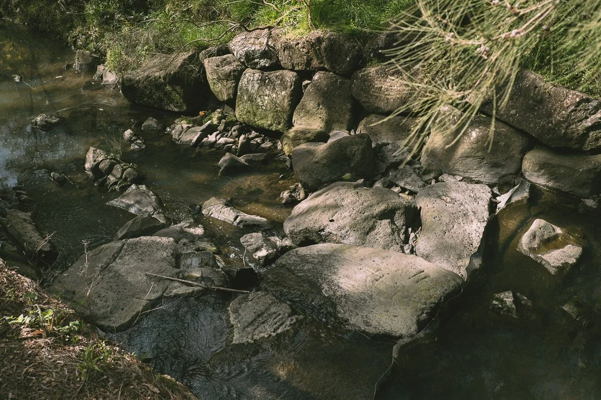
Thousands of years of Country
For many thousands of years, the creek and its surrounding bushland was used and cared for by the Wurundjeri people of the Kulin nation. Tangible evidence of their presence has been found in a number of registered Aboriginal cultural heritage sites along the creek.
The Yarran Dheran Advisory Committee acknowledges the Wurundjeri Woi-wurrung people as the Traditional Custodians of the land on which the reserve and creek corridor sit, and pays respect to their Elders past, present and emerging.
-
Deep
historyWurundjeri Country
The creek and its surrounding bushland was used and cared for by the Wurundjeri people of the Kulin nation across many thousands of years. Registered Aboriginal cultural heritage sites along the creek are tangible evidence of this enduring presence.
-
1830s
onwardsColonial settlement
Colonial settlement beginning in the 1830s resulted in the displacement of First Nations people. Clearing the forests for timber products and charcoal burning was followed by grazing, viticulture, orcharding, and mining, ultimately resulting in residential urbanisation.2
-
1969
Freeway proposal
The Mullum Mullum Valley was determined to be the site for a freeway. Environmental groups, the local community, and all local councils united in opposition to the plan.
-
2000
Eastlink tunnels
Following sustained pressure from environmental groups, the community, and support from all local councils, the state government decided to build two tunnels for what became the Eastlink Tollway beneath the Mullum Mullum Valley. With portals at Park Road Donvale and Deep Creek Road Ringwood, the tunnels were built to preserve and protect the ecological and landscape values of the valley.
Etymology
The creek
Mullum Mullum
Mullum Mullum is adapted from Woiwurrung language and is thought to mean 'place of many big birds', 'place of many big owls', or 'place of butterflies'.
The reserve
Yarran Dheran
Yarran Dheran is also adapted from Woiwurrung language and thought to mean 'wattle gully.' The Reserve is well known for its abundance of wattles. It is noted … Of the 23 species of Acacia that are found in the Melbourne region, 14 have been recorded growing in the Mitcham area, within this open forest structure …1
Land Tenure, Governance and Maintenance
The Mullum Mullum Creek is managed by Melbourne Water. Its surrounding bushland comprises 21% public land and 79% private land, with three Councils having responsibility: Manningham; Maroondah and Whitehorse.
- Manningham
- Maroondah
- Whitehorse
Issues and Challenges
As an urban waterway, the Mullum Mullum Creek corridor is subject to a number of seemingly intractable threats and impacts.10
-
Stormwater issues
Volume and quality, including pollution and litter, which likely arise from:
- Highly urbanized parts of the catchment
- Upstream concentration of light industry and retail areas
- Remaining unsewered residential areas in downstream areas
-
Activity Centres
The potential impact of Activity Centres, as proposed by state government, including the threat of increased erosion.
-
Weeds
Weeds affecting vegetation structure and diversity of flora.
-
Fragmentation
Fragmentation affecting connectivity.
Yarran Dheran Nature Reserve as part of the Mullum Mullum Valley
Yarran Dheran Nature Reserve is situated on the southern bank of the Mullum Mullum Creek. As Crown land, it is managed by the City of Whitehorse with the assistance of the Yarran Dheran Advisory Committee, which has developed a significant role in providing community-based education focused on the environmental values of Yarran Dheran, as well as supporting and maintaining the indigenous flora in the Reserve.
Land on the northern bank of the creek, also Crown land, once known as the Chaim Court bushland, is managed by the City of Manningham with delegations to Parks Victoria. This now forms part of the Mullum Mullum Linear Park which continues from Croydon to Templestowe. Yarran Dheran remains under the management of City of Whitehorse.
Flora and Fauna in the Mullum Mullum Valley and Yarran Dheran Nature Reserve
Flora
EVC 127 · Valley Heathy ForestThe predominant Ecological Vegetation Community (EVC) in Yarran Dheran and the Mullum Mullum Valley is Valley Heathy Forest (EVC 127). Once both common and widespread, Yarran Dheran represents one of the few remaining areas of this now endangered EVC.11
Typical plant species include canopy trees such as Eucalyptus viminalis, Eucalyptus melliodora and Allocasuarina littoralis, with the profuse middle storey dominated by Acacia spp., Bursaria spinosa, Cassinia spp., and Leptospermum continentale. The ground storey includes prostrate heathy shrubs, climbers, herbs and orchids, including Hardenbergia violacea and Xanthorrhoea minor.12
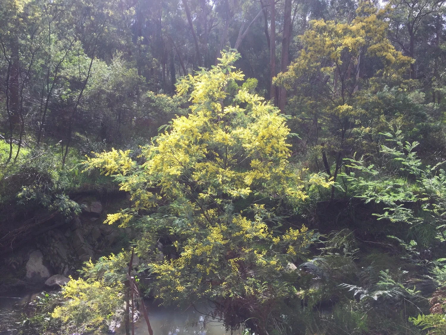
Wattle (Acacia spp.) in flower at Yarran Dheran — the reserve's name means 'wattle gully' in Woiwurrung
Fauna
Fauna that has been identified in Yarran Dheran includes Swamp Wallabies, Eastern Grey Kangaroos, echidnas, Eastern Long-necked Turtles, seven species of frogs, Short Finned Eels, several species of snake, and birds such as Owlet Night-jars and Boobook Owls.131415
The environmental features of Yarran Dheran offer considerable opportunity for more detailed study.
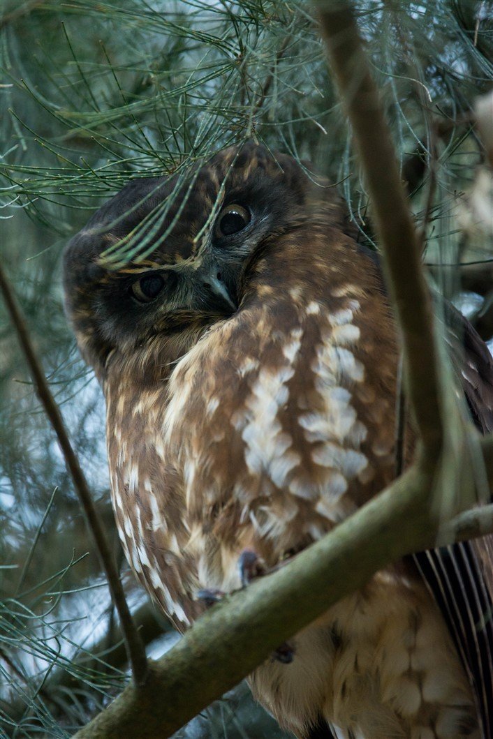
Boobook Owl at Yarran Dheran Nature Reserve, June 2018
Mullum Mullum Creek and Landmarks
This is an aerial map showing the route taken by the Mullum Mullum Creek from its source near Highland Avenue in Croydon and its passage through Ringwood, Mitcham, and Manningham to its confluence with the Yarra River at Templestowe.
Click to enlarge
Geology of the Mullum Mullum Catchment
Study has been made of specific areas within what has been described as Divisions within Victoria.5 The Mullum Mullum Creek and its Corridor fall within what is described as the Port Phillip Division and the general findings applying to the general vicinity of the Yarra River and its catchment6 may apply.
Most of the exposed foundation of the Port Phillip Division area is indicated to consist of folded sedimentary rock strata of Silurian to early Devonian age — 540–380 Ma (million years ago) — as part of the Paleozoic Era.
The Mullum Mullum Creek itself has a rocky base. Ecologically, the Silurian elements have given us clay soils which dry out in summer.7
It is possible that closer field work and analysis may identify sandstone, mudstone and siltstone.
There is great geological diversity around the Port Phillip area. Included are rocks and sediments of almost all major types and origins (other than regional metamorphics) ranging from possibly the oldest in Victoria to the youngest, giving an insight into much of the state's geological history.
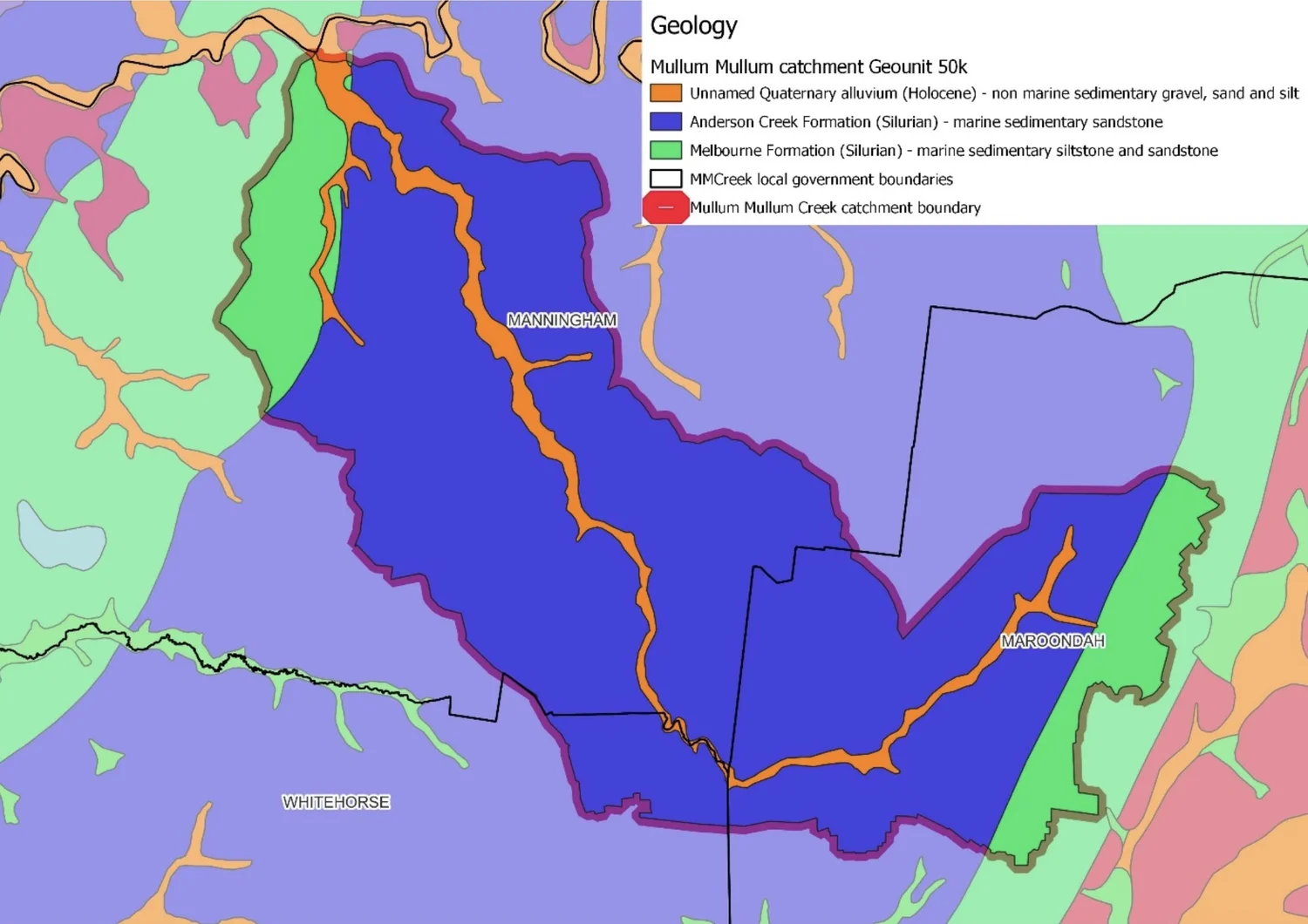
The very idea of local geology is fraught and localised outcrops make sense only in a broader context.
Geology is the study of the Earth, the rocks it is made of and the processes that shape its surface. Australia, which was once a part of the supercontinent Gondwana, is an ancient land with some of the oldest rocks, which were formed when the Earth's crust started to cool approximately 4 billion years ago. The geology of this ancient landmass plays an important role in producing different soil types and landforms, which create the different and unique ecosystems we have.4
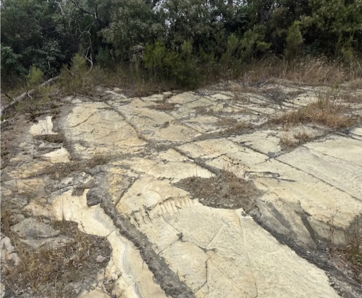
Possible sandstone at the Eastlink ventilation stack at Deep Creek Road
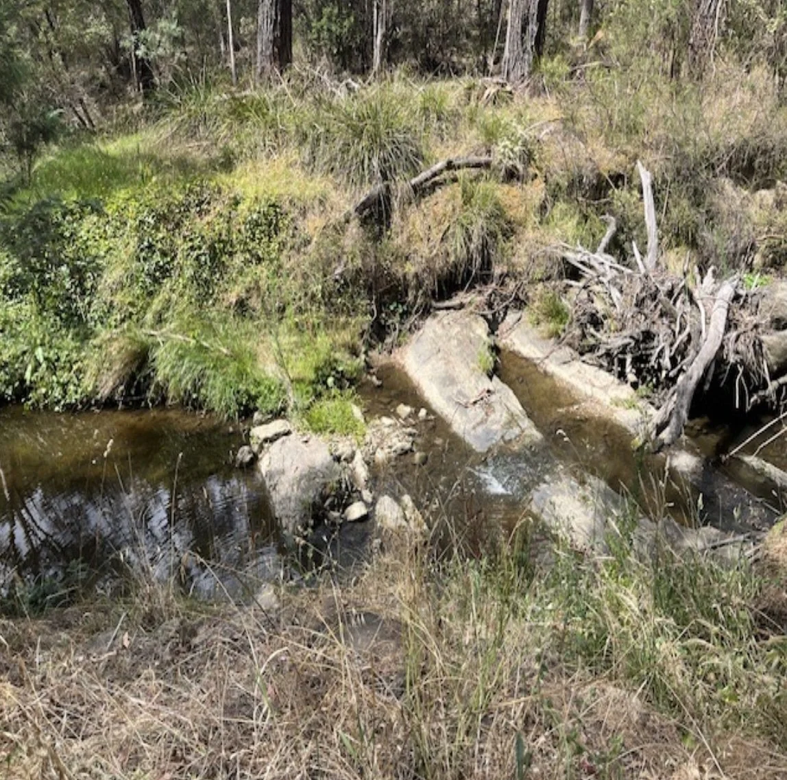
The 'rocky bottom' of the Mullum Mullum Creek can be observed at many locations
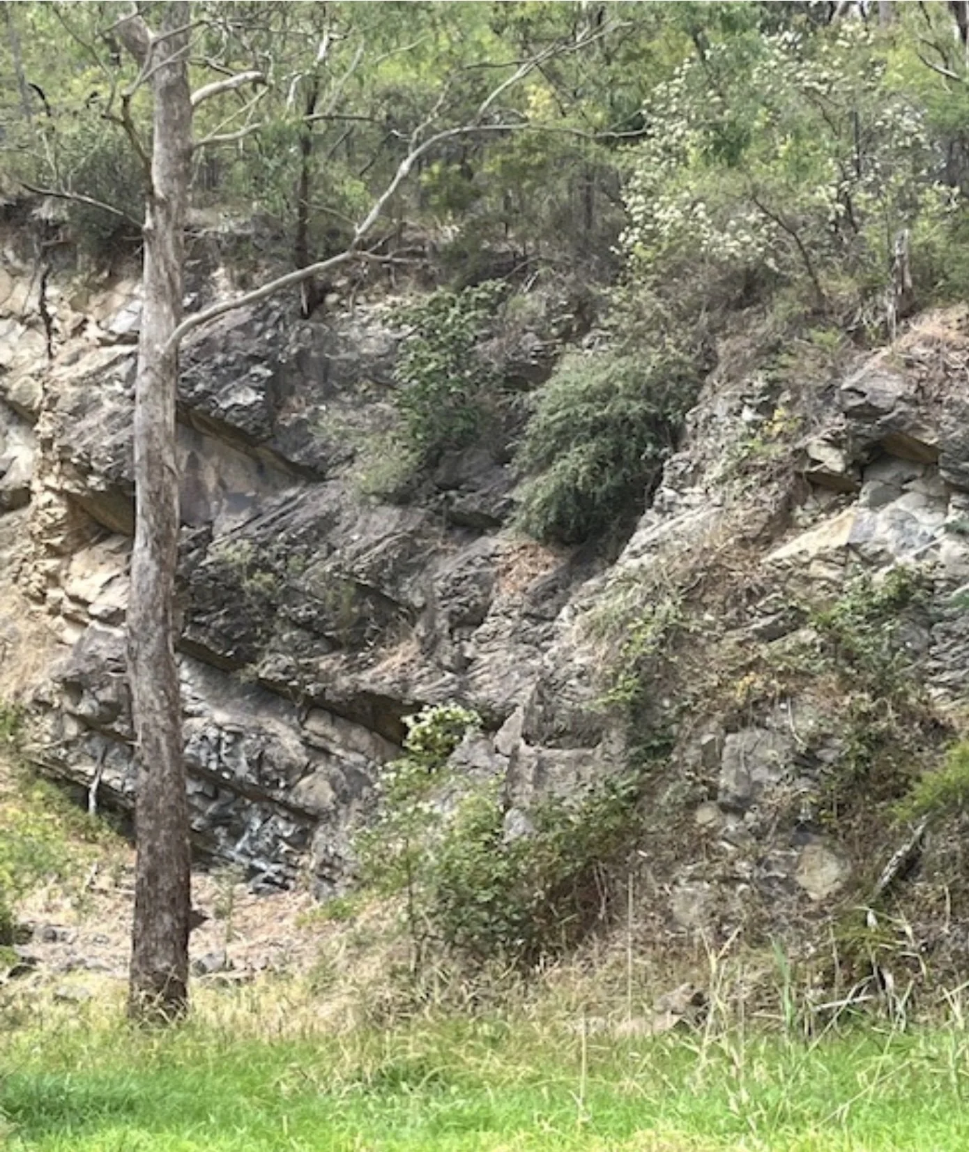
Site of the commercial quarry in Yarran Dheran known to have operated until at least 1893
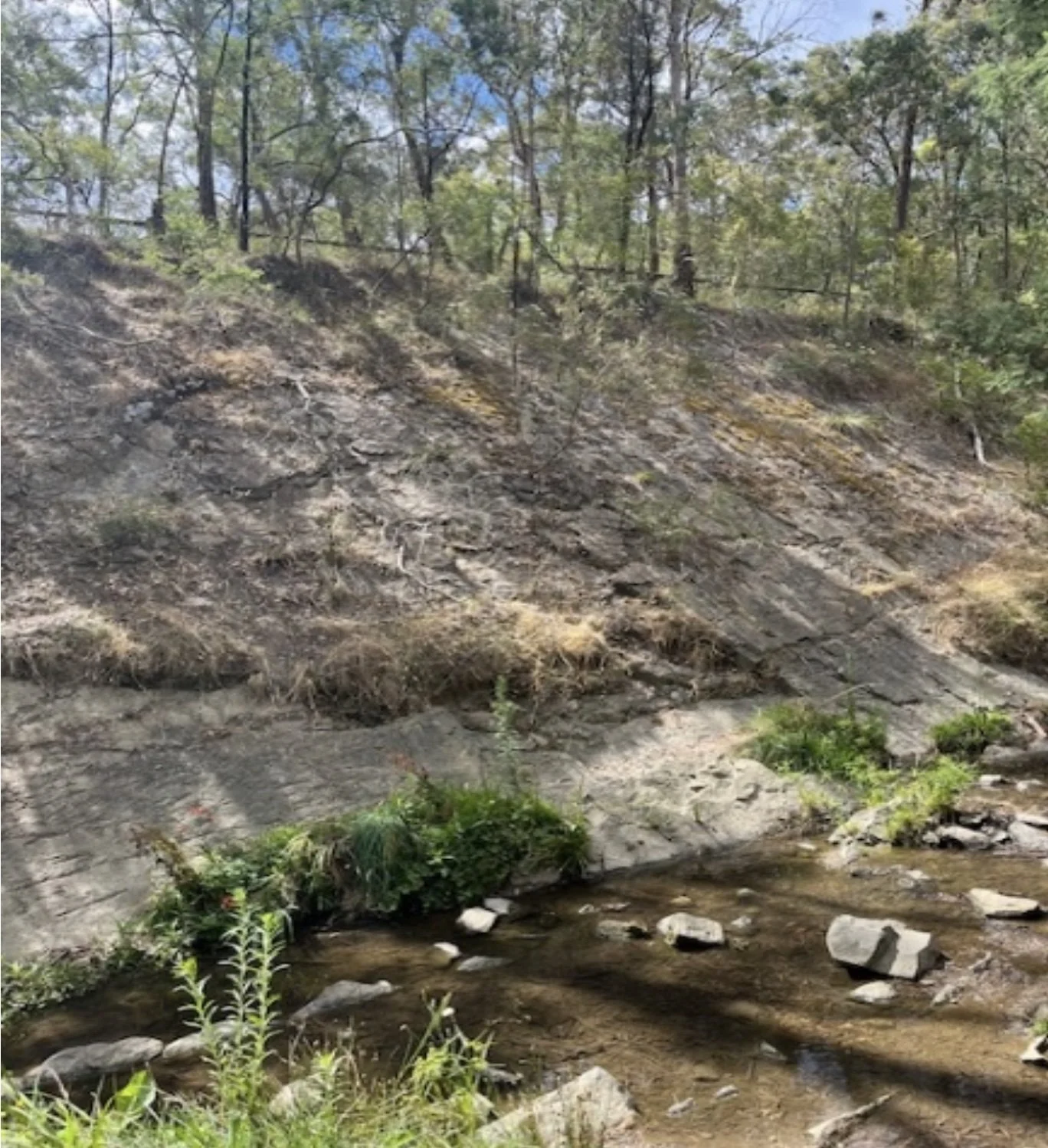
The escarpment at the location along the creek known as 'The Beach'
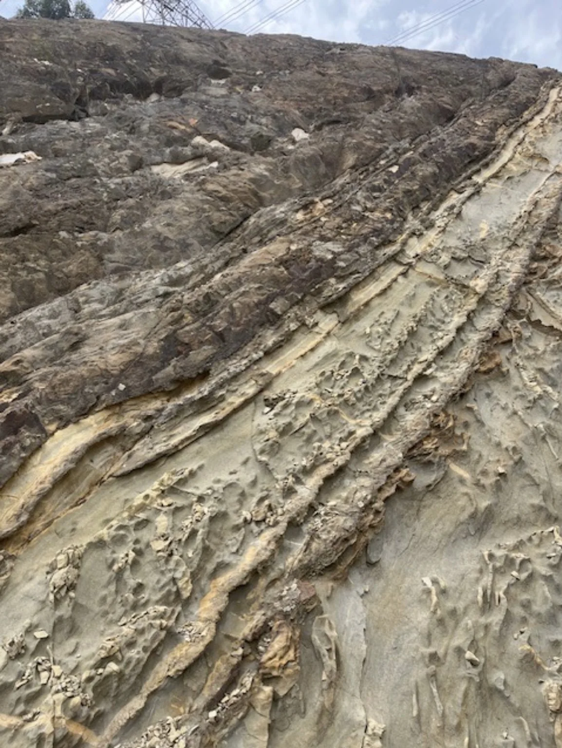
Folded sedimentary rock exposed along the walking trail from the Eastlink Ventilation Stack to Ringwood
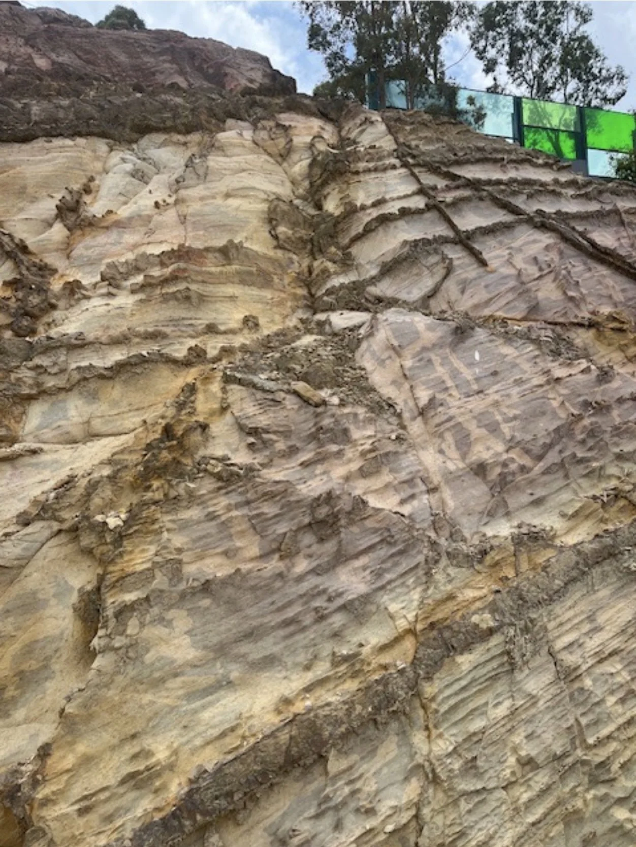
Folded sedimentary rock exposed along the walking trail from the Eastlink Ventilation Stack to Ringwood
Further study
Further field work and study is necessary to identify and understand the geology of the Mullum Mullum Valley.9 Some data may already exist — Eastlink records are likely to include information on rock removed as part of tunnel construction. Additionally, while historical references are made to stone being quarried within Yarran Dheran, the precise nature of the stone quarried is not identified.
-
1
Presland, Gary, The Place for a Village; how nature has shaped the city of Melbourne, Museum Victoria, 2009, p. 129
-
2
Mullum Mullum Creek Collaboration, Mullum Mullum Creek Collaboration Strategic Blueprint 2025–2035; a collaborative blueprint for the Mullum Mullum Creek, its catchment and its community. Contact Maroondah City Council – City Futures (Strategic Planning and Sustainability) ph 03 9298 4598 maroondah@maroondah.vic.gov.au
-
3
Map provided by Maroondah City Council
-
4
Ken Griffiths, Field Naturalists Society of Victoria
-
5
Leon Costermans & Fons VandenBerg, Stories beneath our feet; exploring the geology and landscapes of Victoria and Surrounds, Costermans Publishing, Frankston, 2022
-
6
See for example Leon Costermans & Fons VandenBerg, pp 303–304 Yarra Glen – Lilydale
-
7
Bull, Marilyn, Flora of Melbourne, 4th ed. (2014)
-
8
Map provided by Maroondah City Council
-
9
Some data may already exist and this requires initial research. For example, Eastlink records are likely to include information on rock removed as part of tunnel construction. Additionally, while historical references are made to stone being quarried within Yarran Dheran, the precise nature of the stone quarried is not identified.
-
10
Mullum Mullum Creek Collaboration, Mullum Mullum Creek Collaboration Strategic Blueprint 2025–2035. Contact Maroondah City Council – City Futures (Strategic Planning and Sustainability) ph 03 9298 4598 maroondah@maroondah.vic.gov.au
-
11
Bull, Marilyn, Flora of Melbourne, 4th ed. (2014)
-
12
For a more comprehensive identification of plants currently found in Yarran Dheran, see Yarran Dheran Nature Reserve Biodiversity · iNaturalist
-
13
For records of wildlife sightings reported in Yarran Dheran since 2002, see the Yarran Dheran Reserve website at yarrandheran.org including Wildlife at Yarran Dheran. See also Yarran Dheran Biodiversity Project
-
14
For records of bird sightings at Yarran Dheran and the Mullum Mullum Valley, see Yarran Dheran Reserve–Mullum Mullum Park, Manningham, Victoria, Australia – eBird Hotspot
-
15
For records of Quarterly Frog Surveys at Yarran Dheran, see yarrandheran.org